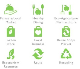
Twenty years ago New Yorker Wendy Brawer had the idea of creating a map of the sustainable places and businesses and initiatives in her neighbourhood. Today she runs an organisation called Green Map® System, which helps individuals and groups all around the world make (both printed and virtual) maps of their cities using 170 specially designed icons to show the things that are important in their area. And by doing so, they find they are helping change the world.
ARC interviewed Wendy by SKYPE (You can download this interview as a PDF file by clicking here )
Q: HOW DOES IT WORK?
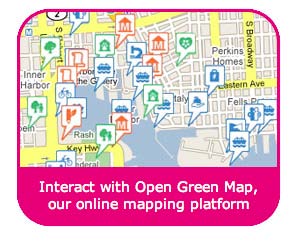
A: There are several ways to begin to create a Green Map, though now that we have created an easy way to make interactive Open Green Maps, many people start on the internet with our Google Map-based platform, and then later decide whether to progress to a paper map, or make a mural, or make it available as a download or a widget. In any format, Green Maps elevate resources for quality living, share fresh perspectives that motivate action and bridge cultural divides, helping communities of all kinds inclusively make progress towards a sustainable future.
Q: WHAT IS OPEN GREEN MAP?
A: OpenGreenMap.org is a resource for collecting data about your area, and instantly publishing it on the internet and mobile phone apps, using Green Map Icons to highlight natural, cultural and green living resources. Each site is designed to share the public’s images, videos, descriptions and PDFs. These low-cost ‘social maps’ can be created instead of, or additional to, a printed map.
Q: WHO MAKES THESE MAPS?
A: Since we make adaptable tools, sometimes individuals create a map, although more often it is groups – school classes, university students, NGOs, government employees, women’s groups, church groups, faith organisations or many others. You don’t have to all be in the same room to work together on a map, though it helps to have a vision of what you want your map to be. Sometimes Green Maps are made by a closed group, other times the process is opened to the whole community via workshops, radio, internet, or even through street murals or posters, to encourage people to suggest more sites.
Q: CAN YOU GIVE AN EXAMPLE?
A: Cape Town created a Green Map before the FIFA World Cup Games. People from the city administration and a green blogger worked together and they charted around 50 green sites on the map straight away. Then they did radio shifts asking for people just to call in suggestions for sites on the map. These were also added to their Open Green Map. To benefit the thousands of tourists who came for the games, they created print maps and a wonderful website, for what has become an ongoing community engagement project.
Or just yesterday, here in New Jersey, there was an article about a local Green Map in the local press. It invited people to use the comment box on their website to suggest green sites and by today they already have about eight good suggestions of things to add. It’s really exciting to pull diverse points of view together on a map!
Q: WHAT DO PEOPLE NEED TO DO?
A: Some people, certainly in the beginning, want their map to answer a simple question. That question could be as simple as: where can I find examples of sustainability or green places in my neighbourhood? Others want it to answer a more specific question. The result could be a ‘theme Green Map’ - where are the vegetarian places, or where are gardens where I can deliver compostable material in my neighbourhood? Or where are the polluted places? What you do need is some kind of vision of what you want to achieve together with the map, and who you want it to impact.
As you create the Open Green Map, you don’t have to be in the same place: you might have 8 people in your group who meet once and then everyone goes off in their different directions (so you could have one specialist in archaeology another in biology another in the history of a certain district in your city). For a group excited about the process and dialogue, you might have 50 people who meet once a month, or you might have anything in between. The Open Green Map allows you to have team members who can edit their own sites or you can also have a number of coordinators to work with their own team. We have engagement tools that will help you develop valuable skills in community organizing, project management and communications as you go – we have collected some of the ‘beyond the map’ impacts generated around the world in a book you can download free, too. http://www.greenmap.org/impacts
Q: HOW MUCH DOES IT COST?
A: Our non-profit, Green Map System receives funding from donors, but we also we need a revenue stream to keep us going. Mapmakers are asked to pay an annual Service Support Fee. There is a sliding scale based on your type of organisation and your country’s average income – countries like India pay one third of the fees of countries like the US, starting ay $13 a year. The rates are here or there is a calculator here
We don’t want the money to be a barrier, so the fees are modest and we accept services (such as translation or outreach) as well. You can also pay up to three years at a time with a discount. We really want to encourage participation.
For that fee you get access to the whole toolset – youth, community and interactive resources, our award-winning icons, as well as a profile on the GreenMap.org website, the chance to add blogs, photos, post articles and share your project’s inspiring stories to a global audience via our website, iPhone App and widgets. We have a listserv and ‘lab’ so Mapmakers can contribute to ongoing development, share ideas and help one another thrive.
Q: HOW DO YOU LET PEOPLE SEE THE MAP?
A: All Open Green Maps can be linked from WWW.GreenMap.org as well as the community’s own website. Anyone who makes a Green Map can also request a shorter URL for the map so it’s easier for marketing. They can embed that map in their own website, making it as easy as possible to share it…
One popular feature is that you can make any point on the map the centre point when you embed it. So a faith group might like its place of worship to be the centre point of the map as it appears on its website, while a community group might like its own meeting point to be the centre point of the same map, while there is a citywide view of the same map on our website. And since any green site can appear on multiple Open Green Maps, you can create ‘child maps’ of districts or themes with the same data. One example is Baltimore, where a ‘child map’ celebrates Green Week, highlighting both permanent and temporary sites. Once the week is over, the map is hidden from public view until the next year, but the permanent sites still appear on the main map (which can be seen at BaltoGreenMap.org ).
If you want to reach audiences around the community, your sites can be exported and a map can then be printed on posters or in newspapers, or reproduced on murals and put up at the community centre or library or church “and people will come in and maybe can add something right there”.
Q: CAN THIS BE USED AROUND THE WORLD?
A: Hundreds of maps have been created in 775 communities in 60 countries including about 500 locally designed print maps and 250 Open Green Maps (locating 19,846 green sites altogether). Go to this page to see your nearest map.
At GreenMap.org/home, the newest maps and projects are featured. Right now, it’s on Shamian Island in Guangzhou China, Piracicaba Araras Paulina in Brazil, New Westminster Canada, Tartu in Estonia and Baerbyen Copenhagen.
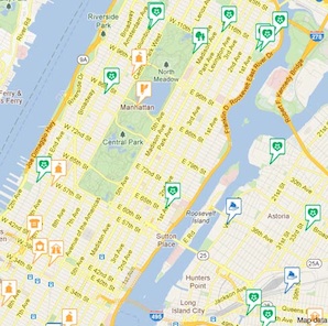
There’s also a world view Open Green Map where you can click a site in your area of interest and jump from directly to that full map (click the map’s name on the site window’s bottom line). These are all based on Google Maps, though in some countries (e.g. Israel and Lebanon) there’s a different view of the basemap within the country from the one you can see outside. But as you can see at the Jerusalem website of the Society for the Protection of Nature in Israel, here wonderful outcomes can be achieved!
Q: IS OPEN GREEN MAPS AN ALTERNATIVE TO CREATING PHYSICAL PRINTED MAPS?
A: It can be an alternative but it does not have to be. Once you have the interactive map, you can design a print map with all the site data. That’s what Cape Town did before the World Cup, as mentioned above. They made it first on the Open Green Map platform, and then they printed the map, circulating a first draft version saying, “what’s missing?” That way they got feedback from people who don’t use the internet. In New York, we went the other direction. At OpenGreenMap.org/compostnyc, you can see our citywide composting map. On the right sidebar, click the Info tab and download the PDF of the print Composting Green Map of Manhattan that we produced in 2008. Reducing waste and restoring the soil is important to people throughout the five boroughs, and our maps help make the case for new policy on waste reduction (and yes, new funding is coming through for composting in 2012!).
Q: WHAT IF YOU WANT A PHYSICAL MAP?
A: A physical printed map is a powerful resource, especially for visitors. However the printing of the map can be expensive: you not only have think about printing but also design, distribution, storage and marketing. We have had some people who have struggled to get funding to pay for the printing until they’ve made an Open Green Map and then they have been able to say to funders: “Look what we have.” And suddenly people can imagine it, and can see how it can be used to motivate people.
Q: ARE THERE OTHER WAYS OF FINANCING PRINTING?
A: You might work with a local newspaper – many projects have been printed as the centre-fold of a magazine or a conference cover. There might be something going on in your city which is already using printing, which would help bring the cost down. Jerusalem’s SPNI has contributed to the City’s map in this way.
Q: WHAT WAS YOUR FIRST MAP?
A: In 1992 I was inspired by the Earth Summit and the idea we can help people connect with the environment and green living close to home. So many people were feeling overwhelmed and thinking how can I begin to make a difference? I began by making a map of the city I love, New York, looking at the sustainable things that were already happening in the place I lived.
The map helped people realise that even in a city like this – which was not very green looking – there are already a lot of initiatives underway. That first map in 1992 had 145 sites on it… The most recent one is closer to 1000.
Since our comprehensive citywide map began to get crowded, we began printing maps on a neighbourhood-by-neighbourhood basis, or by theme. We’ve charted youth views, energy and as mentioned above, composting. New York City currently recycles just 16% of its residential waste and there are a lot of reasons we need that compost apart from the fact it’s costing us a fortune to ship it to another state and then do whatever it is that they do with it.
Our print map led to a tripling of the amount of food and garden scraps being dropped off at the compost centres in Manhattan. And now the Borough has funded another 25 composting demonstration projects. None of these are the scale they need to be, but the map has certainly made a difference.
Q: WHAT ARE YOUR INSPIRATIONS TO KEEP THIS PROGRAMME GOING?
A: There are so many, but one of them is a community programme in Cuba . Groups - often led by women - used the Green Map process to solve problems in the community. Some of the outcomes they had are just amazing. They created new play spaces, a dojo for practicing karate, heat-mitigating gardens and then they started changing policy. Many Cuban cities don’t really have streetlights and part of what they mapped were things like trip hazards, where it was dangerous to be out walking. Things got repaired and improved. Maps proved to be a good way for communities to talk to officials. It uses resources that are already there – volunteers, existing spaces, and found that very small funding that can be raised within the community.
Cuba is a good example of how despite tight resources and low internet access, people of all ages could be involved. A team of biologists worked through the Felix Varela Centre has involved over 100 towns in Cuba, getting everyone, from children to seniors, to map the things in their area. They developed culturally relevant Cuban solutions, including collaboratively painted murals that grace the centre of towns, using modelling clay for 3-D maps and even simply using a copier to make small printed maps. They have annual events and new Mapa Verde songs as well as maps are shared and exchanged.
You can see a series of three videos about the Cuba Green Maps on YouTube called Gotica Y Gotica: the first is here:
(we also highlight a few here, on the GreenMap.org youth intro pages, that appeal to younger audiences, including one made with NYC’s Harlem Green Faith network)
Or there is an example from Salt Lake City in Utah, a pilgrimage city for Mormons. The Utah Repertory Dance Company has been “dancing the Green Map icons” in performance venues and the schools for the past two years. It was addressing the question that people were asking of “why do dance and environment go together?” This culture-changing approach is a good example of how you turn a question like that on its head in a fairly conservative community and make more happen. Follow this lnk to the articles pages of GreenMap.org.
THE FUTURE
We want to work with green pilgrimage network members: the Green Map team will create a logo for the network, and we hope to work together on developing special green pilgrimage icons for the maps.
APPS for iphone and ipad etc: we do have our first Green Map iPhone app and a mobile website at GreenMap.org. We could co-create a specialized Green Pilgrims Green Map app that could be an income stream to ensure the sustainability of our work in the future.
Consultancy: the team is increasingly being invited to be consultants and can help a city strategize and plan a dynamic, impactful project. Find examples at the services pages of GreenMap.org.
Lessons in the technology: I’m working with nine communities as part of a Sustainable New Jersey network. It’s been very interesting to realise there are experience gaps regarding networking and social media that we take for granted. We’ve run a basic workshop three or four times and some people have come back several times.
Green Maps as part of crisis planning: for example in Banda Aceh Indonesian where the mapping process helped not only rebuild community spirit following 2004’s massive tsunami, but also gave people the chance to think about what they wanted their future homes to look like rather than just waiting for outsiders to tell them what they want. Green Mappers in Japan are learning from the Indonesians – as green recovery and new ways to live more lightly are taking hold.
Expand the Widgets: See the resources/widgets page of GreenMap.org where people can easily bring ‘feeds’ of maps, photos, etc into their own website, sharing the world’s outcomes.
Creative Engagement: the world is a beautiful place and we can all create new ways to encourage participation in making it a better home for all!
IDEAS FOR GREEN PILGRIM PLACES TO LEARN FROM
VIDEOs: Great videos can be created with high energy but low technology. This one is a fun way to show the growth of Green Maps:
THINK ABOUT LAUNCHING WITH MAXIMUM EFFECT: On Sikh Environment Day, March 14th 2012, EcoSikh hopes to launch a plan for an Open Green Map of Amritsar, with the target of having a map (or several maps in different Punjab cities) to launch in 2013. Could your city launch the process too? Start at the participation page of GreenMap.org.
GET DIFFERENT GENERATIONS INVOLVED: Sometimes Green Maps involve older people being interviewed by young people: it helps expand the knowledge of neighbourhood, but also has the effect of bringing generations together. Also when young people get involved, it can be a further trigger to change policy.
WHO CAN YOU INVOLVE? Women’s groups? Universities? Schools? Local businesses? Local magazines? Radio stations? Be creative; make your Green Map really open to all.