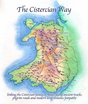
Projects overview
Americas projects
Asia projects
China projects
Education and water
Faith in food
Faiths for Green Africa
Green pilgrimage network
Living churchyards
Long-term plans
Major ARC events
Migration
Religious forests
Retreats
Sacred gifts
Sacred land
Pilgrimage
Beyond Belief: groundbreaking WWF-ARC publication
Sacred gardens
Sacred poems
Holy water
Manchester Diocese
Community
Sacred arts
How to start a Sacred Land project
Sacred Land links
Theology of Land
Sacred Sites
Values
Wildlife
Other projects
Archive
 
ARC Home > Projects > Sacred land :
Pilgrimage | Walsingham pilgrimage trail | The Cistercian Way | Cistercian Way map | Words along the Cistercian Way | Story of a 20th century shrine | Shropshire’s Orthodox monastery

The Cistercian Way

The proposed Cistercian Way: you can also see a larger version of this map

In 1998, to celebrate 900 years of the Cistercian Order, a group of walkers followed a pilgrimage route leading to all the Cistercian Abbeys in Wales – from Tintern Abbey to Caldey Island. They were trying not to reconstruct a medieval pilgrimage – but to use parts of medieval pilgrimage routes to make their own pilgrimage.

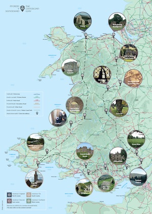
The journey involved between 20 and 100 people walking different sections of the route – with special services held at major sites including Tintern Abbey and Strata Florida.

As they developed the route they concentrated on aspects of ‘green tourism’ – how to mark the routes, maintain stiles, avoid sensitive environmental areas, and use local resources.

The circular route runs clockwise, linking all 16 medieval Cistercian houses in Wales with their two modern successors at Caldey and Whitland. Much of the route north from Strata Florida follows or shadows the Sustrans Welsh cycleway and other stretches are also suitable for cycling, prams and wheelchairs. Many off–road sections are on bridle paths or green lanes.

Links

Cistercian Way website.

Read what pilgrims on the Cistercian Way had to say.

Find out more about the Cistercian Way project from the Heritage Tortoise blog run by Professor Madeleine Gray

The project was supported by Shell Better Britain and the Welsh Historic Monuments Executive Agency (CADW)

< to previous page to top of page to next page >
ARC site map


Related information

January 12 2004:
Pilgrims plan return to Wales
THE Western Mail reports how ARC is helping the sacred and often secret history of Wales to be celebrated with the mapping of a 650-mile pilgrimage route around the nation.
Restoring holy wells
How a holy well in North Cornwell was rediscovered
January 15, 2004:
Welsh local authorities pledge to create Cistercian Way
After nearly five years of discussions, the longest footpath in Wales is about to become a reality - opening up ancient spiritual sites and monastic pathways to modern pilgrims and walkers.